The Hike House

Saturday, December 13th, 2025
Hiking Preparedness + Energy Supply + Apparel & Gear
  • Home
  • Sedona Trail Finder
    • About Sedona Trail Finder
    • List of 101 Sedona Hiking Trails
  • Hiking Preparedness
  • Energy Cafe
  • Trail Apparel
  • Grand Canyon Planning Station
  • Guided Hikes
  • Contact Us

Secret Canyon/D. Miller/ Bear Sign Loop

Tuesday, May 17, 2011 by The Hike House Leave a Comment

The Hike House Sedona Trail Rating System
Secret Canyon/D. Miller/
Bear Sign Loop

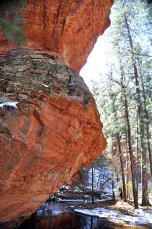
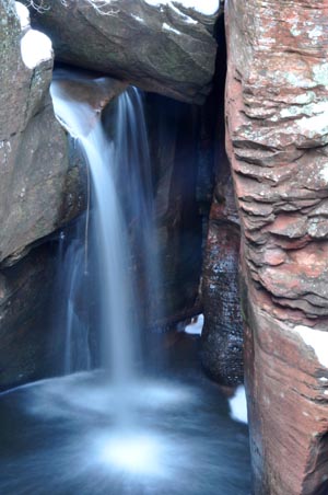
A scenic red rock country loop which involves the use of four trails. It can be hiked in either direction. The clockwise direction loop starting from the Secret Canyon Trailhead is described here. Start at the signed trailhead for the Secret Canyon Trail across the usually dry streambed of Dry Creek west of the parking area. The trail immediately enters Wilderness. The wide, nearly flat trail leads into the wide canyon mouth with nice views, but no shade. At 2/3 mile, the HS Canyon Trail branches off to the left. Continue ahead. At 1.75 miles, turn right onto the David Miller Trail at the signed fork. It climbs gently for about .5 mile then more steeply for another .25 mile to a saddle which overlooks Bear Sign Canyon and the Dry Creek drainage area. The trail now descends steeply 200 feet into Bear Sign Canyon and ends at its intersection with the Bear Sign Trail. Turn right and follow this shady trail to the southeast as it gradually descends beside the canyon drainage for 2.25 miles to the confluence of the Bear Sign and Dry Creek washes. This is also the trailhead for the Bear Sign Trail. Turn right and follow the Dry Creek Trail southward. It follows the usually dry streambed on a gradual descent except for one short climb out of the drainage which allows views over the canyon. After nearly .75 miles on this trail, it crosses the creek, turns left and ends at the trailhead parking area shared with the Vultee Arch Trail. To complete the loop, follow the road southwest for about 1 mile to return to the Secret Canyon Trail parking area.

Trail Data

Distance: 3.65/7.3 miles (One way/Round Trip)
Time: 5 hours (Round Trip)
Elevation Change: 800 ft.
Difficulty: Difficult

Trail Rating

VN:RO [1.9.8_1114]
Overall
Views
Difficulty
Rating: 4.0/5

Video Slideshow and Commentary Coming Soon

Sedona Trail Rating System

The Hike House Sedona Trail Rating System provides actual hiker feedback and ratings of each of the Sedona hiking trails. The cumulative trail ratings for the Secret Canyon/D. Miller/ Bear Sign Loop submitted by fellow hikers is located above with the Trail Data. Your trail feedback and ratings are an important resource for fellow hikers and provide a personal account of your trail experience from which others may learn. So please hike Sedona, help others, and rate a trail today!

Filed Under: Sedona Trail Rating System Tagged With: hiking sedona, Secret Canyon/D. Miller/ Bear Sign Loop, The Hike House

Secret Canyon Trail

Tuesday, May 17, 2011 by The Hike House 5 Comments

The Hike House presents the Sedona Trail Rating System
Secret Canyon Trail

The trail immediately enters Wilderness. The wide, nearly flat trail leads into the wide canyon mouth with nice views, but no shade from the desert scrub vegetation. At 2/3 mile, HS Canyon Trail branches off to the left. About 2 mi. in the David Miller Trail over to Bear Sign Canyon departs to the right. Vegetation varies from chaparral to mixed conifer along this typically dry water course. After 2 mi. there is shade from oak and ponderosa and nice views of red rock formations. This hike can be extended further into the narrowing box canyon for up to an 11 mi. round trip. (Coconino National Forest) Click here to download a pdf version.

Trail Data

Distance: 5.5/11 miles (One way/Round Trip)
Time: 6 hours (Round Trip)
Elevation Change: 600 ft.
Difficulty: Moderate

Trail Rating

VN:RO [1.9.8_1114]
Overall
Views
Difficulty
Rating: 4.0/5

View the Secret Canyon Trail Slideshow and Commentary

Secret Canyon Trail Image 1
Secret Canyon Trail Image 2

Sedona Trail Rating System

The Hike House Sedona Trail Rating System provides actual hiker feedback and ratings of each of the Sedona hiking trails. The cumulative trail ratings for the Secret Canyon Trail submitted by fellow hikers is located above with the Trail Data. Your trail feedback and ratings are an important resource for fellow hikers and provide a personal account of your trail experience from which others may learn. So please hike Sedona, help others, and rate a trail today!

Filed Under: Sedona Trail Rating System Tagged With: hiking sedona, secret canyon trail, The Hike House

Rams Head

Tuesday, May 17, 2011 by The Hike House Leave a Comment

The Hike House Sedona Trail Rating System
Rams Head

Trail Description

Trail Data

Distance: 0/0 miles (One way/Round Trip)
Time: 0 hours (Round Trip)
Elevation Change: 0 ft.
Difficulty: Easy

Trail Rating

VN:RO [1.9.8_1114]
Overall
Views
Difficulty
Rating: 3.3/5

Video Slideshow and Commentary Coming Soon

Sedona Trail Rating System

The Hike House Sedona Trail Rating System provides actual hiker feedback and ratings of each of the Sedona hiking trails. The cumulative trail ratings for the Rams Head submitted by fellow hikers is located above with the Trail Data. Your trail feedback and ratings are an important resource for fellow hikers and provide a personal account of your trail experience from which others may learn. So please hike Sedona, help others, and rate a trail today!

Filed Under: Sedona Trail Rating System Tagged With: hiking sedona, Rams Head, The Hike House

Schnebly Hill Trail

Tuesday, May 17, 2011 by The Hike House 1 Comment

The Hike House Sedona Trail Rating System
Schnebly Hill Trail

The Schnebly Hill Trail climbs moderately and steadily up the west face of Schnebly Hill following the original alignment of Schnebly Hill Road. There are some magnificent red rock views for the first .75 miles which is unshaded. The trail enters partial shade and at 1.25 miles, where the roadbed turns sharply to the left, take the trail on the right which is signed “Munds, Jacks, Hot Loop”. It climbs moderately in shade for nearly .75 mile, passing through 2 cattle gates, and emerging on a large, open expanse near Committee Tank. There are several overlooks offering great views of Munds Mountain, Bear Wallow Canyon and the red rock formations beyond. The trail is level for the next quarter mile and then descends to a saddle separating Schnebly Hill and Munds Mountain at the head of Jacks Canyon. More nice views. Just before reaching the saddle, there is a signed trailhead on the left for Hot Loop. Continue down another 150 yards where there are two more signed trailheads. The Jacks Canyon Trail leads down to the left.

Trail Data

Distance: 2.4/4.8 miles (One way/Round Trip)
Time: 2.5 hours (Round Trip)
Elevation Change: 1000 ft.
Difficulty: Moderate

Trail Rating

VN:RO [1.9.8_1114]
Overall
Views
Difficulty
Rating: 4.0/5

Video Slideshow and Commentary Coming Soon

Sedona Trail Rating System

The Hike House Sedona Trail Rating System provides actual hiker feedback and ratings of each of the Sedona hiking trails. The cumulative trail ratings for the Schnebly Hill Trail submitted by fellow hikers is located above with the Trail Data. Your trail feedback and ratings are an important resource for fellow hikers and provide a personal account of your trail experience from which others may learn. So please hike Sedona, help others, and rate a trail today!

Filed Under: Sedona Trail Rating System Tagged With: hiking sedona, Schnebly Hill Trail, The Hike House

Scheurman Mountail Trail

Tuesday, May 17, 2011 by The Hike House 2 Comments

The Hike House Sedona Trail Rating System
Scheurman Mountail Trail

This is a good trail that climbs gently for .2 miles to the base of the low mountain, then bends to the left and begins a moderately steep climb up the east flank and onto the basaltic lava of this old volcano. Nice views. The trail turns right (west) into a small drainage and continues to climb, emerging on a low saddle at .5 miles where it intersects a north/south trail. Turn right (north) and follow the path as it climbs gently for .25 miles to the mountain’s high point. Go a bit further to the edge for great panoramic views. 

Return to the junction with the upcoming trail. For more great views, continue ahead for 50 yards to a well-defined fork. The right branch crosses the top of the mountain and drops down to Lower Red Rock Loop Road. Take the left fork (east) which gently climbs, ending after .33 miles on a point of land among large basalt blocks. This vantage point offers wonderful views all around. Return by the same route. This trail is unshaded and can be hot in summer.

The elevation at the trailhead is 4,450 feet. The high point is 4,800 feet, a gain of 350 feet.

Trail Data

Distance: 1/2 miles (One way/Round Trip)
Time: 1.5 hours (Round Trip)
Elevation Change: 350 ft.
Difficulty: Moderate

Trail Rating

VN:RO [1.9.8_1114]
Overall
Views
Difficulty
Rating: 3.7/5

Video Slideshow and Commentary Coming Soon

Sedona Trail Rating System

The Hike House Sedona Trail Rating System provides actual hiker feedback and ratings of each of the Sedona hiking trails. The cumulative trail ratings for the Scheurman Mountail Trail submitted by fellow hikers is located above with the Trail Data. Your trail feedback and ratings are an important resource for fellow hikers and provide a personal account of your trail experience from which others may learn. So please hike Sedona, help others, and rate a trail today!

Filed Under: Sedona Trail Rating System Tagged With: hiking sedona, Scheurman Mountail Trail, The Hike House

  • « Previous Page
  • 1
  • …
  • 5
  • 6
  • 7
  • 8
  • 9
  • …
  • 23
  • Next Page »

Sedona's #1 Hiking Guide Book
Discover the "Top 30 Trails"

Book a Guided Hike Adventure

Diabetic Boot Camp
Trail Experience of the Month
Sedona Hiking Clinic

Sedona Trail Rating System

  • Review Trail Ratings
  • Rate a Hiking Trail

Hike House Videos

  • The Hike House's 5 Elements
  • Sedona Trail Finder
  • The Hike House Channel on Youtube

Sign up for our Email Newsletter Email Newsletter icon, E-mail Newsletter icon, Email List icon, E-mail List icon

News

  • Hogs Trail
  • Hi Line Trail
  • Hangover Trail
  • Biological Soil Crust: Holding the Place in Place
  • Capturing Sedona’s Beauty

Like Us On Facebook

Latest Article

Hogs Trail

Wednesday, May 18, 2016 1 Comment

Hogs Trail One of the most underrated areas in Sedona is Munds Wilderness. Many people in the past would take on this area because the predominant trail for this area, Broken Arrow, is adjacent to a heavily traveled jeep road. A new day has arrived…while you still must hike a portion of Broken Arrow to get to Hogs, the trail departs from the … [Read More...]

Our Location


The Hike House
431 State Route 179
Sedona, AZ 86336
928-282-5820
Hours of Operation
Mon-Sat 9:00 am - 6:00 pm
Sunday   9:00 am - 5:00 pm
Click here for Map.

Return to top of page
© 2025 The Hike House
Log in