The Hike House

Tuesday, December 16th, 2025
Hiking Preparedness + Energy Supply + Apparel & Gear
  • Home
  • Sedona Trail Finder
    • About Sedona Trail Finder
    • List of 101 Sedona Hiking Trails
  • Hiking Preparedness
  • Energy Cafe
  • Trail Apparel
  • Grand Canyon Planning Station
  • Guided Hikes
  • Contact Us

Little Horse Trail

Wednesday, May 4, 2011 by The Hike House 4 Comments

The Hike House Sedona Trail Rating System
Little Horse Trail

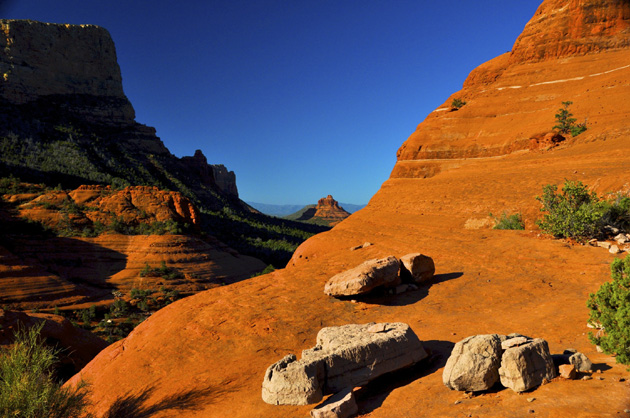
Little Horse Trail begins as part of the Bell Rock Pathway. Follow this wide trail southward for ¼ mile. Here, at a signed fork, take the old jeep road branching to the left and marked with basket cairns. The road drops to cross a dry streambed, climbs a bit and ends at the ¾ mile point. The trail continues to the left and climbs moderately, topping out on a large, flat expanse. Turn to the right here. The level trail leads into a stand of Arizona cypress and intersects a trail on the left coming from the chapel as it nears the “Madonna and the Nuns” spires. Nice views. At 1.4 miles, it passes through a gate. Continue for 150 yards passing the base of the knobs of Chicken Point on the left. Take the path left for a short climb onto the bare rock for wonderful views. This point is used by jeep tours via Broken Arrow Road. Return by the same route for a 3 mile roundtrip hike . The hike can also be extended eastward from the base of Chicken Point into the Wilderness area (no bicycles allowed) on the Jim Bryant Trail. Little Horse Trail is mostly unshaded and hot in summer.

Trail Data

Distance: 1.5/3 miles (One way/Round Trip)
Time: 2.5 hours (Round Trip)
Elevation Change: 400 ft.
Difficulty: Easy
Map: Click here for a map of Little Horse trail.

Trail Rating

VN:RO [1.9.8_1114]
Overall
Views
Difficulty
Rating: 3.7/5

View the Little Horse Trail Slideshow and Commentary

Little Horse Trail Image

Sedona Trail Rating System

The Hike House Sedona Trail Rating System provides actual hiker feedback and ratings of each of the Sedona hiking trails. The cumulative trail ratings for the Little Horse Trail submitted by fellow hikers is located above with the Trail Data. Your trail feedback and ratings are an important resource for fellow hikers and provide a personal account of your trail experience from which others may learn. So please hike Sedona, help others, and rate a trail today!

Filed Under: Sedona Trail Rating System Tagged With: hiking sedona, Little Horse Trail, The Hike House

Lime Kiln Trail

Wednesday, May 4, 2011 by The Hike House Leave a Comment

The Hike House Sedona Trail Rating System
Lime Kiln Trail

The Lime Kiln Road was constructed at the same time as the kiln to bring lime from the kiln to the Willard and Strahan house construction sites. Eventually the road continued beyond the Lime Kiln to connect into the Oak Creek Road, and became known as the Lime Kiln Cut-Off. This route became a favorite route for early settlers of the upper Verde Valley because it was considerably shorter than the main road. The road was constructed for horse and wagon use and was abandoned by the time automobile use became popular (Willard 1979). 

The Lime Kiln Trail is 15 miles long. Nine miles are non-motorized and six miles are motorized. Access points include Dead Horse Ranch State Park, The Bill Grey Road, Hwy 89A, The Deer Pass Road (FR 89B), Lower Red Rock Loop Road and Red Rock State Park.

Trail Data

Distance: 15/30 miles (One way/Round Trip)
Time: 14 hours (Round Trip)
Elevation Change: 350 ft.
Difficulty: Moderate

Trail Rating

VN:RO [1.9.8_1114]
Overall
Views
Difficulty
Rating: 3.7/5

Video Slideshow and Commentary Coming Soon

Sedona Trail Rating System

The Hike House Sedona Trail Rating System provides actual hiker feedback and ratings of each of the Sedona hiking trails. The cumulative trail ratings for the Lime Kiln Trail submitted by fellow hikers is located above with the Trail Data. Your trail feedback and ratings are an important resource for fellow hikers and provide a personal account of your trail experience from which others may learn. So please hike Sedona, help others, and rate a trail today!

Filed Under: Sedona Trail Rating System Tagged With: hiking sedona, Lime Kiln Trail, The Hike House

Jordan Trail

Wednesday, May 4, 2011 by The Hike House Leave a Comment

The Hike House Sedona Trail Rating System
Jordan Trail

The Jordan Trail and Cibola Pass Trail are part of the North Urban Trail System. This series of interconnected trails run along the red rock front country at the north edge of Sedona and the southern boundary of the Red Rock-Secret Mountain Wilderness. Beginning from the north end of Uptown Sedona, the Jordan Trail curves around the southerntip of Cibola Ridge, overlooking several prominent rock formations. The Cibola Pass Trail crosses over the ridge, looping back to the trailhead. The hike includes a side trip to Devil’s Kitchen if you choose to hike a short distance down Soliders Pass which is located at the end of the trail.

Trail Data

Distance: 1.25/2.5 miles (One way/Round Trip)
Time: 1.5 hours (Round Trip)
Elevation Change: 200 ft.
Difficulty: Easy

Trail Rating

VN:RO [1.9.8_1114]
Overall
Views
Difficulty
Rating: 3.5/5

Video Slideshow and Commentary Coming Soon

Sedona Trail Rating System

The Hike House Sedona Trail Rating System provides actual hiker feedback and ratings of each of the Sedona hiking trails. The cumulative trail ratings for the Jordan Trail submitted by fellow hikers is located above with the Trail Data. Your trail feedback and ratings are an important resource for fellow hikers and provide a personal account of your trail experience from which others may learn. So please hike Sedona, help others, and rate a trail today!

Filed Under: Sedona Trail Rating System Tagged With: hiking sedona, Jordan Trail, The Hike House

Jim Thompson Trail

Wednesday, May 4, 2011 by The Hike House Leave a Comment

The Hike House Sedona Trail Rating System
Jim Thompson Trail

Built by Jim Thompson in 1887. This trail can be hiked from either the Wilson Canyon Trailhead (as described here) or the Jordan Road Trailhead . From Midgely Bridge parking area, start along the road past the picnic ramada. At .1 miles, bear right onto the trail marked by large rock cairns. It gradually climbs, then descends to the canyon drainage. At .6 miles, pass the fork signed for Wilson Mountain Trail and 100 yards further, take the left fork signed for Jim Thompson Trail. It immediately begins a .2 mile moderate climb. Bear right as you top out and after 100 yards, take the left fork (to the right is a path onto Steamboat Rock). The trail is wide and nearly flat with sparse shade as it follows an old road along the base of Steamboat Rock and past Steamboat Tank on the right at 1.5 miles. Nice views. 

At 2.25 miles, the trail passes through a cattle gate, becoming narrower and more shaded as it gently descends into Mormon Canyon. At the bottom, the trail bends right into the canyon a short way before joining the start of Brins Mesa Trail on a closed road at 3 miles. The Jordan Road Trailhead parking area is 150 yards south (left) down the road just past the gate. Return by the same route for a 6 mile roundtrip hike or hike one way in either direction with arranged transportation.

Trail Data

Distance: 3/6 miles (One way/Round Trip)
Time: 3 hours (Round Trip)
Elevation Change: 400 ft.
Difficulty: Easy

Trail Rating

VN:RO [1.9.8_1114]
Overall
Views
Difficulty
Rating: 3.3/5

Video Slideshow and Commentary Coming Soon

Sedona Trail Rating System

The Hike House Sedona Trail Rating System provides actual hiker feedback and ratings of each of the Sedona hiking trails. The cumulative trail ratings for the Jim Thompson Trail submitted by fellow hikers is located above with the Trail Data. Your trail feedback and ratings are an important resource for fellow hikers and provide a personal account of your trail experience from which others may learn. So please hike Sedona, help others, and rate a trail today!

Filed Under: Sedona Trail Rating System Tagged With: hiking sedona, Jim Thompson Trail, The Hike House

Javalina-Apache Fire Trail Loop

Wednesday, May 4, 2011 by The Hike House Leave a Comment

The Hike House Sedona Trail Rating System
Javalina-Apache
Fire Trail Loop

The Javalina Trail and Apache Fire Trail loop through the upper slopes of the Red Rock State Park through a pinyon pine and juniper woodland. The trail begins on the Bunkhouse Trail in the meadow above Oak Creek and leaves the meadow, crossing the creek on Kingfisher Bridge. The Kisva Trail climbs to the east end of the park and is a connector route for both trails.

Trail Data

Distance: 1/2 miles (One way/Round Trip)
Time: 1 hour (Round Trip)
Elevation Change: 100 ft.
Difficulty: Not Difficult

Trail Rating

VN:RO [1.9.8_1114]
Overall
Views
Difficulty
Rating: 3.0/5

Video Slideshow and Commentary Coming Soon

Sedona Trail Rating System

The Hike House Sedona Trail Rating System provides actual hiker feedback and ratings of each of the Sedona hiking trails. The cumulative trail ratings for the Javalina-Apache Fire Trail Loop submitted by fellow hikers is located above with the Trail Data. Your trail feedback and ratings are an important resource for fellow hikers and provide a personal account of your trail experience from which others may learn. So please hike Sedona, help others, and rate a trail today!

Filed Under: Sedona Trail Rating System Tagged With: hiking sedona, Javalina-Apache Fire Trail Loop, The Hike House

  • « Previous Page
  • 1
  • …
  • 8
  • 9
  • 10
  • 11
  • 12
  • …
  • 21
  • Next Page »

Sedona's #1 Hiking Guide Book
Discover the "Top 30 Trails"

Book a Guided Hike Adventure

Diabetic Boot Camp
Trail Experience of the Month
Sedona Hiking Clinic

Sedona Trail Rating System

  • Review Trail Ratings
  • Rate a Hiking Trail

Hike House Videos

  • The Hike House's 5 Elements
  • Sedona Trail Finder
  • The Hike House Channel on Youtube

Sign up for our Email Newsletter Email Newsletter icon, E-mail Newsletter icon, Email List icon, E-mail List icon

News

  • Hogs Trail
  • Hi Line Trail
  • Hangover Trail
  • Biological Soil Crust: Holding the Place in Place
  • Capturing Sedona’s Beauty

Like Us On Facebook

Latest Article

Hogs Trail

Wednesday, May 18, 2016 1 Comment

Hogs Trail One of the most underrated areas in Sedona is Munds Wilderness. Many people in the past would take on this area because the predominant trail for this area, Broken Arrow, is adjacent to a heavily traveled jeep road. A new day has arrived…while you still must hike a portion of Broken Arrow to get to Hogs, the trail departs from the … [Read More...]

Our Location


The Hike House
431 State Route 179
Sedona, AZ 86336
928-282-5820
Hours of Operation
Mon-Sat 9:00 am - 6:00 pm
Sunday   9:00 am - 5:00 pm
Click here for Map.

Return to top of page
© 2025 The Hike House
Log in